A good-looking house plan can fail before construction if the lot cannot legally, physically, or affordably accept it. Before paying for detailed drawings, the team should test what the parcel allows, where the ground can support a house, how vehicles reach it, and where services enter.
A lot-first house plan starts with the buildable envelope, not the floor plan
For a residential lot, the first design decision is the buildable envelope created by zoning, easements, terrain, access, drainage, and utilities. Style comes after the team knows where the house can sit and what site costs must be carried.
The buildable envelope is the part of the lot left after setbacks, easements, height limits, coverage limits, flood constraints, access routes, drainage paths, and utility routes have been mapped. Local planning departments usually start with zoning because zoning assigns permitted use and development intensity to a parcel. As a general primer, California YIMBY’s Elements of Zoning describes zoning as a primary tool cities use to regulate land function and built form.
What should someone searching for house designers near me ask before reviewing style portfolios?
A homeowner searching for house designers near me should ask site-feasibility questions before judging rooflines, kitchen layouts, or exterior materials. A portfolio shows taste; the first interview should show whether the designer can keep an attractive plan out of the permit office’s rejection pile.
- Ask who confirms zoning. The local planning department, zoning official, or planning consultant should confirm the district, overlays, and interpretation questions.
- Ask whether a current survey is required. A final plan based only on a tax map, listing sketch, or old mortgage drawing is a risk.
- Ask how easements are handled. Utility, drainage, access, conservation, and shared driveway easements can remove buildable area.
- Ask who checks access and services. A civil engineer, surveyor, road authority, fire official, or utility provider may need to confirm driveway grades, meters, poles, and trench routes.
Which lot documents should be collected before the first design meeting?
The first meeting works better when the owner brings the land paper trail: deed, recorded plat, title exceptions, subdivision restrictions, homeowners association rules, prior surveys, tax parcel map, utility records, septic or well records if applicable, floodplain references, and prior permits.
The house designer can translate those documents into design consequences, but some questions need other professionals. A surveyor confirms boundaries, encroachments, easements, and topography. An attorney interprets disputed rights and deed restrictions. A civil engineer studies grading, drainage, driveways, stormwater, and utility routing. A geotechnical engineer becomes important where slope, fill, expansive soil, groundwater, or landslide risk could change the foundation.
A current survey and topographic base map prevent expensive schematic design mistakes
A recent boundary and topographic survey gives the designer a measured base for property lines, elevations, easements, utilities, trees, structures, drainage features, and adjacent grades. Without that base, the plan may be accurate on paper and wrong on the ground.
What elevations and site features should the topographic survey show for residential architectural design?
A residential topographic survey should give the team enough information to set floor elevations, foundation exposure, driveway approach, drainage routes, and outdoor living areas.
A current survey and topographic base map prevent expensive schematic design mistakes shown as an editorial planning reference.
- Boundary information: property corners, lot lines, rights-of-way, encroachments, visible fences, walls, and recorded easements when available.
- Vertical information: contours, spot elevations, road crown, curb, sidewalk, driveway tie-in points, drainage inlets, swales, ditches, culverts, and low points.
- Site obstructions: existing structures, retaining walls, large trees, rock outcrops, utility poles, overhead wires, meters, wells, septic components, and visible utility routes.
- Adjacent conditions: neighboring grades, shared drives, sidewalk elevations, road edges, and drainage patterns that could affect runoff.
Contour intervals can be broad on simple lots and tighter on steep, irregular, or drainage-sensitive sites. A mortgage location drawing usually does not replace this work because it may satisfy a lender without mapping the ground accurately enough for design.
When does the house designer need a civil engineer or geotechnical engineer before concept design is finished?
Early civil input is prudent when the lot has steep slopes, poor drainage, a floodplain concern, a long driveway, a culvert, stormwater detention, utility extensions, or retaining walls that shape the house location. Early geotechnical input is prudent when the parcel shows fill, expansive soil, soft bearing conditions, high groundwater, landslide risk, unusual settlement, or a likely need for deep foundations.
Setbacks, easements, lot coverage, and height limits decide where the house can legally sit
Zoning rules and recorded private restrictions convert a parcel into a smaller usable building area. Front, side, and rear setbacks; utility and drainage easements; maximum lot coverage; floor-area limits; height rules; and environmental buffers can all override the preferred room layout.
How close to the edge of the property can a house be built?
A house can be built only as close to the property line as the applicable zoning district, recorded plat, easements, and overlays allow. Setbacks are the required minimum distance between a structure and a lot line, and they commonly differ at the front, side, rear, and street-side yard on a corner lot. New York City’s residential bulk regulations, for example, separate front yard, side yard, rear yard, lot coverage, height, and density topics rather than treating the lot edge as one simple rule.
Local zoning may also regulate lot size, floor area ratio, building height, lot coverage, and density. California YIMBY’s zoning primer explains lot coverage as the share of a parcel covered by structures and floor area ratio as total floor area compared with lot area, but the actual numbers must come from the local ordinance for the parcel.
What are the rules for setback variances and why should they not be assumed?
A setback variance is a discretionary approval, not a design tool to spend before the risk is accepted. Zoning boards often look for a unique site condition, practical hardship, minimum necessary relief, and limited impact on neighbors, but each jurisdiction writes its own test.
Recorded restrictions can be stricter than municipal zoning. WeConservePA explains that deed restrictions and conservation easements can restrict land use through recorded legal instruments that bind current and future owners.
Which lot constraints should be shown in a simple buildable-area table?
| Constraint | Where to verify it | Plan impact | Professional to ask |
|---|---|---|---|
| Setbacks | Zoning code and survey | Moves exterior walls | Planner, surveyor |
| Easements | Plat, title report, deed | Blocks building or grading | Surveyor, attorney |
| Lot coverage | Local zoning worksheet | Limits footprint and patios | Designer, planner |
| Impervious area | Stormwater rules | Changes driveway and drainage | Civil engineer |
| Height limit | Zoning height definition | Changes roof and floor levels | Architect, planner |
| Floodplain | Local floodplain review | Raises floor elevation | Civil engineer |
Los Angeles’s New Zoning Code shows why definitions matter: Article 14 includes measurement rules for building footprint, covered area, floor area, grade plane elevation, yards, public access easements, and slope. It also treats certain overhead spaces as covered or uncovered based on whether 25 percent or more of the area opens to the sky.
Setbacks, easements, lot coverage, and height limits decide where the house can legally sit shown as an editorial planning reference.
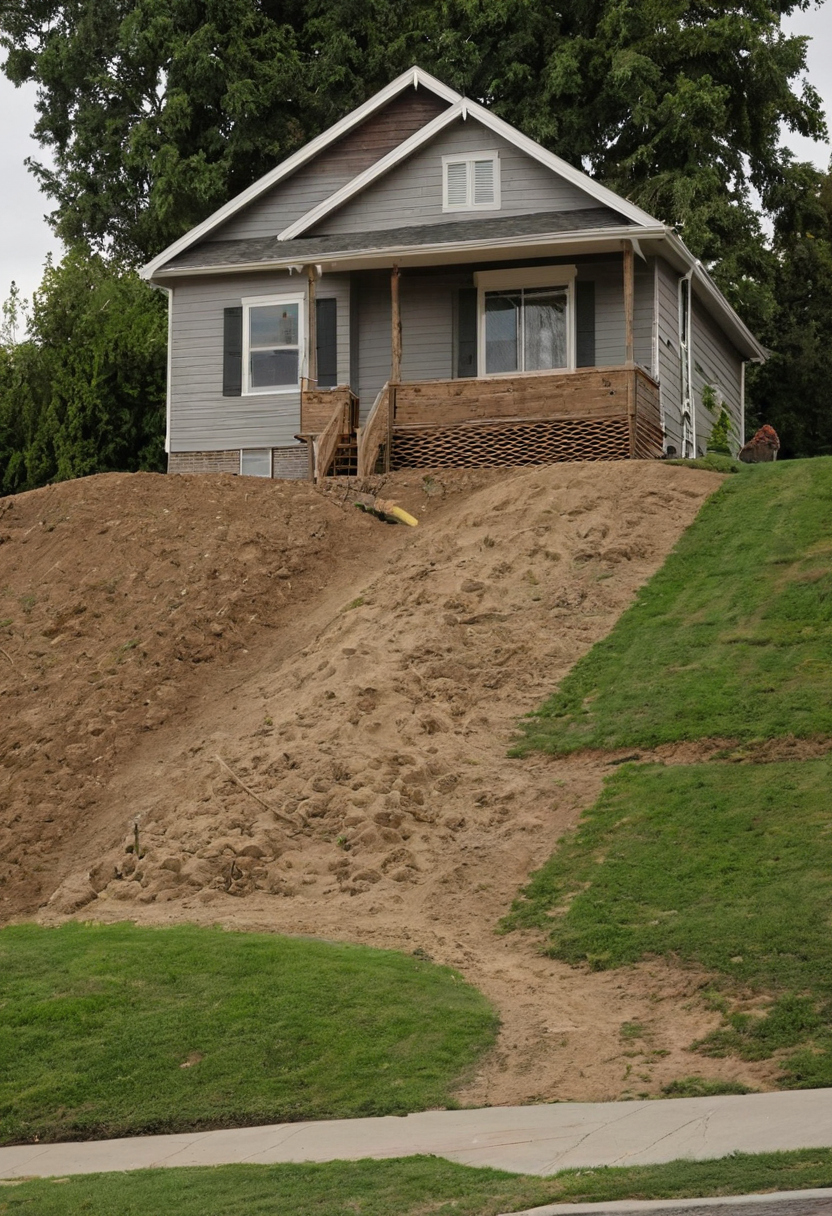
Slope changes the house type, foundation strategy, drainage plan, and construction cost
On a sloping or hilly residential lot, the best house design works with existing grade rather than forcing a flat plan onto uneven ground. Slope can favor a walkout basement, stepped floor levels, pier foundations, retaining walls, or a compact footprint that reduces excavation.
Which house design is best suited for a sloping or hilly lot?
Residential teams often sort a site as flat, moderate, or steep before exact engineering starts. A flat site may allow a slab-on-grade or simple crawlspace. A moderate slope may suit a stepped foundation, split-level plan, or walkout lower level. A steep site usually needs structural coordination before room layouts become fixed.
A downslope lot often places the garage and public entry near the street, with living areas or bedrooms opening to the lower view side. A walkout basement can work where the grade drops enough to expose a full wall and water can drain away from the foundation.
An upslope lot may need a higher entry, tucked garage, or stair sequence from parking to the main floor. Excavation into the hill can create usable floor area, but cut walls, waterproofing, and uphill drainage become part of the budget.
A cross-slope lot pushes the plan sideways. The designer may step the floor plate along the contour, narrow the footprint, or consider piers and grade beams where cutting a full bench would remove too much soil.
How do retaining walls and drainage details change the architectural design budget?
Retaining walls are not just landscape edges. A wall may need structural design, footing excavation, drainage aggregate, waterproofing, guardrails, and equipment access. Local building departments commonly review retaining walls based on height, surcharge, property-line proximity, guard requirements, and drainage impact.
Drainage on a sloped lot needs a route, not a wish. Common components include foundation drains, subdrains behind retaining walls, swales, area drains, daylight outlets, erosion control, and required stormwater measures. These items affect door thresholds, basement feasibility, terrace levels, planting zones, and hardscape durability.
Driveway, fire access, parking, and construction access can reshape the house before rooms are drawn
Access is both a daily-use design issue and a permit issue. Driveway slope, turning radius, fire apparatus access, garage approach, parking location, delivery route, and construction staging can determine the house’s entry level, width, orientation, and excavation plan.
Driveway, fire access, parking, and construction access can reshape the house before rooms are drawn shown as an editorial planning reference.
When does driveway gradient force a different garage or entry design?
Driveway gradient becomes a design driver when the street sits well above or below the preferred floor level, the lot is narrow, or the garage faces a short setback. Local public works standards may control apron geometry, sight distance, drainage, culverts, paving surface, and maximum slope. Many driveways also need flatter transitions at the street and garage so cars do not scrape and runoff does not enter the house.
Steep access can push the plan toward a lower-level garage, side-entry garage, detached garage, switchback drive, parking court, or narrower building footprint. If the driveway is drawn late, the project can inherit an unusable garage approach, an unpriced retaining wall, or a permit comment that forces the entry sequence to change.
What should be checked for fire department and emergency access before schematic design?
Fire access should be checked early on long driveways, flag lots, rural parcels, gated entries, hillside sites, and lots with limited street frontage. The local fire marshal or code official may review access-road width, grade, turnaround geometry, surface capacity, vertical clearance, address visibility, gates, hydrant distance, water supply, and conditions that require sprinklers or turnouts.
Construction access belongs in the same conversation. Concrete trucks, excavation equipment, cranes, delivery vehicles, soil hauling, temporary stockpiles, and erosion-control measures all need space before finished parking is available.
Water, sewer, power, gas, drainage, and telecom service routes influence the floor plan and site plan
Utilities are routing, trenching, clearance, and equipment decisions that affect room placement, foundation penetrations, driveway layout, landscape space, and construction order. Utility availability should be confirmed before the architectural design depends on an unverified service path.
How do sewer, septic, and stormwater requirements limit where the house can go?
Public sewer usually starts with a connection point, invert elevation, tap approval, capacity confirmation, and a lateral route across the lot. If gravity flow cannot work, a pump system can change the basement elevation, mechanical location, emergency power planning, and maintenance access.
Septic design can control the site more aggressively than the house footprint. The septic field, reserve area, well, building, property lines, water bodies, slopes, trees, and drainage features may all need separation distances set by the local health department or environmental authority. On some lots, the usable house area is the space left after wastewater is solved.
Stormwater planning adds another layer. New roof, driveway, patio, and pool deck area may trigger grading plans, erosion control, infiltration, detention, approved discharge points, or limits on sending runoff toward a neighbor. A clean floor plan can still fail if drainage has no legal or buildable path.
Where should meters, panels, mechanical rooms, and service entries be planned?
Utility providers should be asked for service location, meter location, transformer needs, connection fees, easement requirements, trenching rules, and capacity confirmation. Electric, gas or propane, water, sewer, drainage, and telecom routes can conflict with trees, retaining walls, driveways, foundations, patios, pools, and future planting beds.
Service areas work best when the design groups meters, panels, shutoffs, hose bibbs, cleanouts, heat-pump equipment, battery storage, generator pads, and telecom boxes where crews can reach them without damaging the facade or waterproofing. All-electric design, solar readiness, EV charging, and heat pumps may also change panel sizing, conduit paths, and exterior equipment space.
Water, sewer, power, gas, drainage, and telecom service routes influence the floor plan and site plan shown as an editorial planning reference.
Price the service routes before detailed drawings begin, because utility extensions, pump systems, drainage structures, and equipment clearances belong in the pre-design budget rather than appearing as late site-plan corrections.
A responsible pre-design workflow prices site risk before detailed architectural drawings
The safest workflow spends modestly on site due diligence before committing to detailed plans. The process should move from document review to survey, zoning check, utility confirmation, access review, engineering flags, preliminary budget, and only then refined architectural design.
A responsible house designer or architect should finish this stage with a buildable-envelope diagram, a survey-based site plan, a zoning summary, a utility and drainage assumption list, a slope and access risk note, and a preliminary cost range that separates house cost from site cost.
What are the four types of building plans a homeowner may see, and which ones depend on lot data?
Homeowners usually see four plan families as a project advances: feasibility drawings, schematic design drawings, construction drawings, and permit drawings. Naming varies, but any drawing that locates the house on the land depends on verified lot data.
- Feasibility drawings test whether the house can fit. The site plan, buildable envelope, driveway sketch, septic or sewer assumption, and drainage concept need survey data, setbacks, easements, topography, and utility locations.
- Schematic design drawings test the house idea. Floor plans, exterior elevations, and building sections can start with assumptions, but those assumptions must match the site plan before the design becomes expensive to change.
- Construction drawings tell trades what to build. Foundation plans, framing plans, wall sections, roof plans, window schedules, and assemblies need stable decisions about grade, structure, drainage, and access.
- Permit drawings prove compliance. The permit set often combines architectural, structural, civil, utility, and energy information, depending on local review requirements.
What should be decided before paying for full construction drawings?
Before full construction drawings, the team should confirm setbacks, easements, lot coverage, height limits, floodplain status, current survey information, driveway feasibility, utility routes, drainage concept, foundation direction, retaining wall assumptions, and a preliminary cost range with separate allowances for excavation, utility extensions, and stormwater work.
Some items can remain provisional at schematic stage: cabinet layout, finish selections, fixture models, interior door profiles, and decorative lighting. Site-dependent items should not remain unknown: house location, finished floor elevation, garage access, sewer or septic path, stormwater outlet, retaining wall strategy, and service-entry locations.
Do I need a survey before hiring a house designer near me?
You can interview a designer before ordering a survey, but you should not pay for full site-dependent drawings without a current survey base. The survey gives the designer the property lines, grades, easements, and site features that control the plan.
Which house design works best on a sloping or hilly lot?
The best design usually follows the grade. A walkout basement, stepped plan, compact footprint, or pier-supported structure may cost less and perform better than forcing a flat plan onto a sloped site.
Late redesign often comes from the same discoveries: a setback line cutting through a room, a utility easement blocking a garage, a driveway too steep for the preferred entry, unsuitable soil under a shallow foundation, or stormwater that cannot discharge where the first sketch assumed.